Interested in using Humap for a grant-funded project? Our Bid Kit has all of the information you’ll need for a great application.
You can also check out Inherited Places, a Humap guest blog on prehistoric archaeology by Dr Samantha Brummage, PhD.


Interested in using Humap for a grant-funded project? Our Bid Kit has all of the information you’ll need for a great application.
You can also check out Inherited Places, a Humap guest blog on prehistoric archaeology by Dr Samantha Brummage, PhD.
Digventures is a crowdsourced, crowdfunded organisation making archaeology accessible to everyone.
In 2021, they teamed up with Humap to try out our map-drawing tool: Placemaker.
Prefer video? Our former co-founder and co-director Ed Jones gave a talk on Placemaker and Digventures at GeoMob. Ed’s talk begins at 5:52.
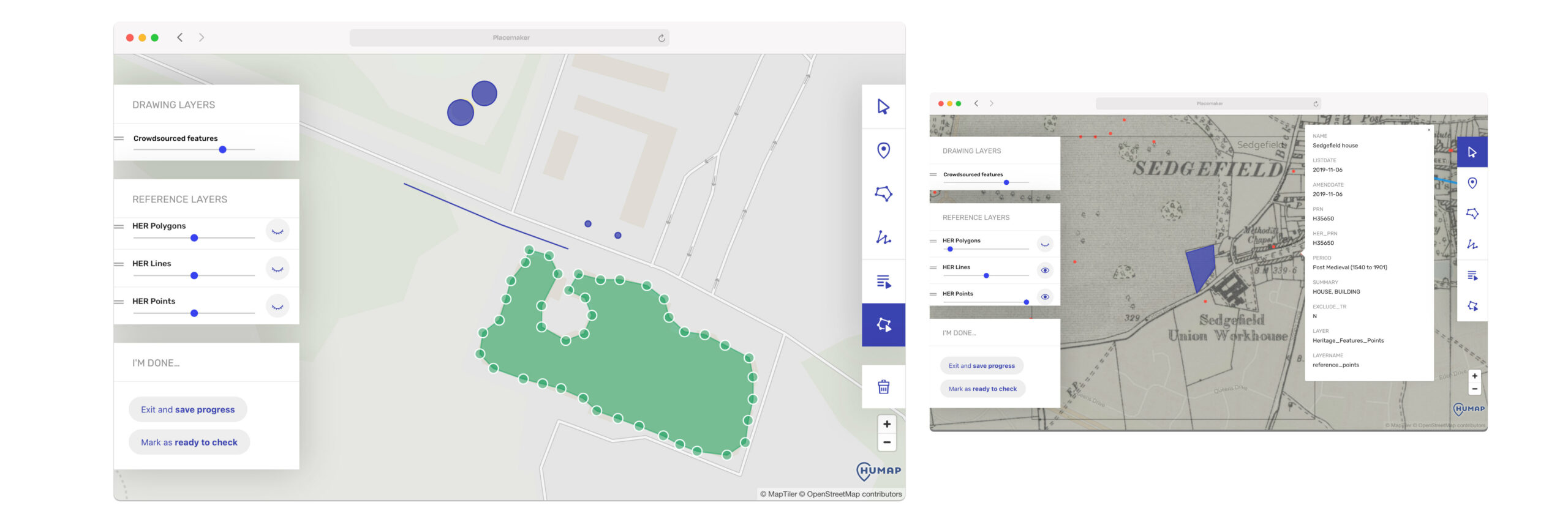
H.E.R’s (Historic Environment Records) exist for every area of the U.K., but are often unreliable or incomplete. Digventures and ArchAI, funded by a Nesta Collective Intelligence Grant, set out to find out how crowd intelligence and artificial intelligence could work together to identify sites of archaeological interest and improve the reliability of existing H.E.R’s.
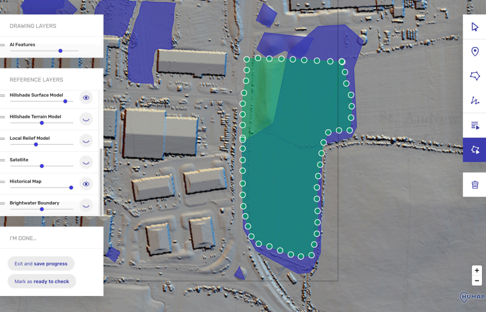
Using Placemaker to manually explore layers of map data (LiDAR, satellite, historical etc) and mark places of interest with drawing tools and metadata, the Digventures volunteers created a data set to teach the AI how to identify archaeological sites.
Everything the volunteers made was saved to a central database that could be returned to, saved in geometries in PostGIS for ease of exporting and analysis,
You can find out more about the AI side of the project here.
Why does this matter? In the words of Digventures themselves, this partnership has the potential “to inform spatial planning, de-risking development and landscape transformation whilst embedding local people in the decisions which deeply impact their lives.”
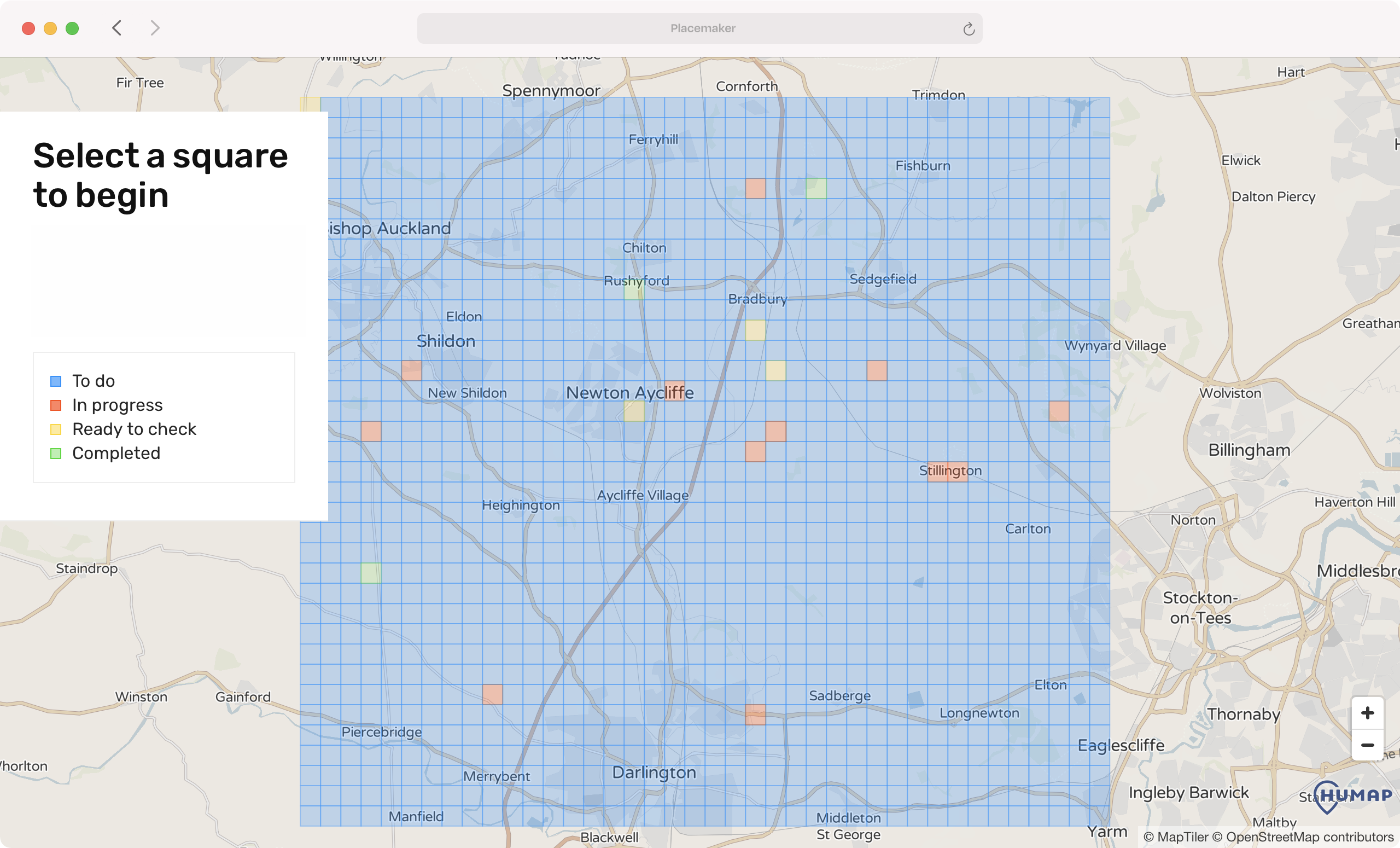
The project clearly demonstrated the interest that the public have in archaeology – 970 applications were received for 100 spots – and the power of crowdsourced archaeological participation.
How did the volunteers do?
Community involvement and online presence are crucial for modern archaeology.
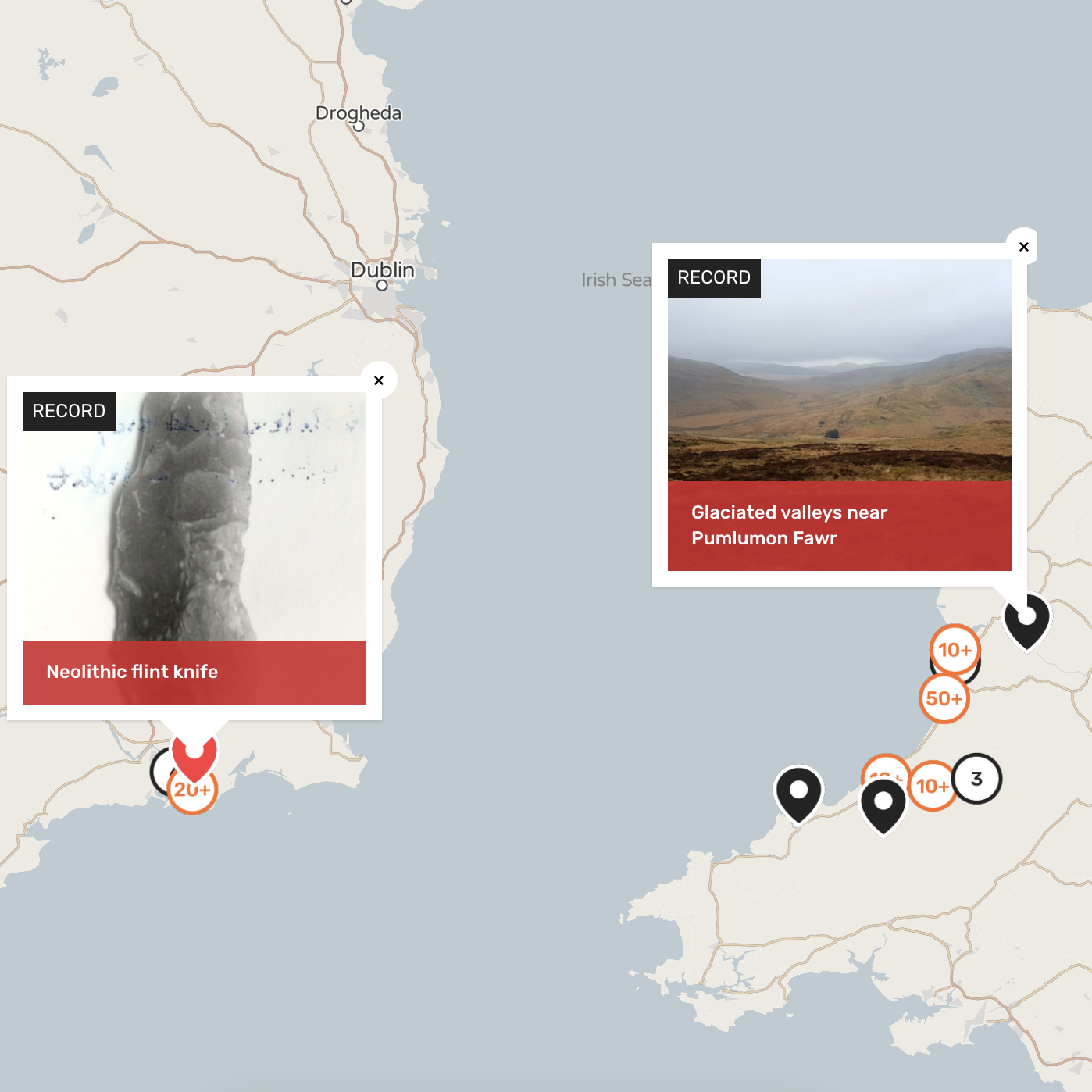
The Portalis project is a collaboration between the University of Wales Trinity Saint David, the South East Technology University of Ireland, Waterford City and County Council, and Ceredigion County Council.
This multidisciplinary team is investigating the earliest voyages between Wales and Ireland, and community engagement and the production of educational resources are central to the project. The Portalis team is using Humap to turn their data into an interactive, multimedia repository of their findings that’s accessible to everyone.
You can also see this in action on Layers of London, which contains over 790 records and 25 collections tagged with “archaeology”!