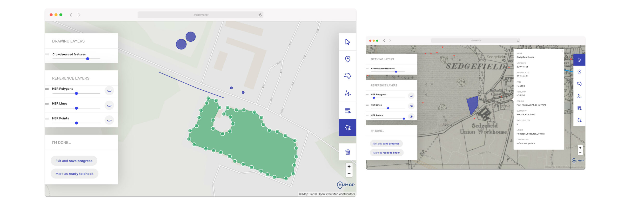
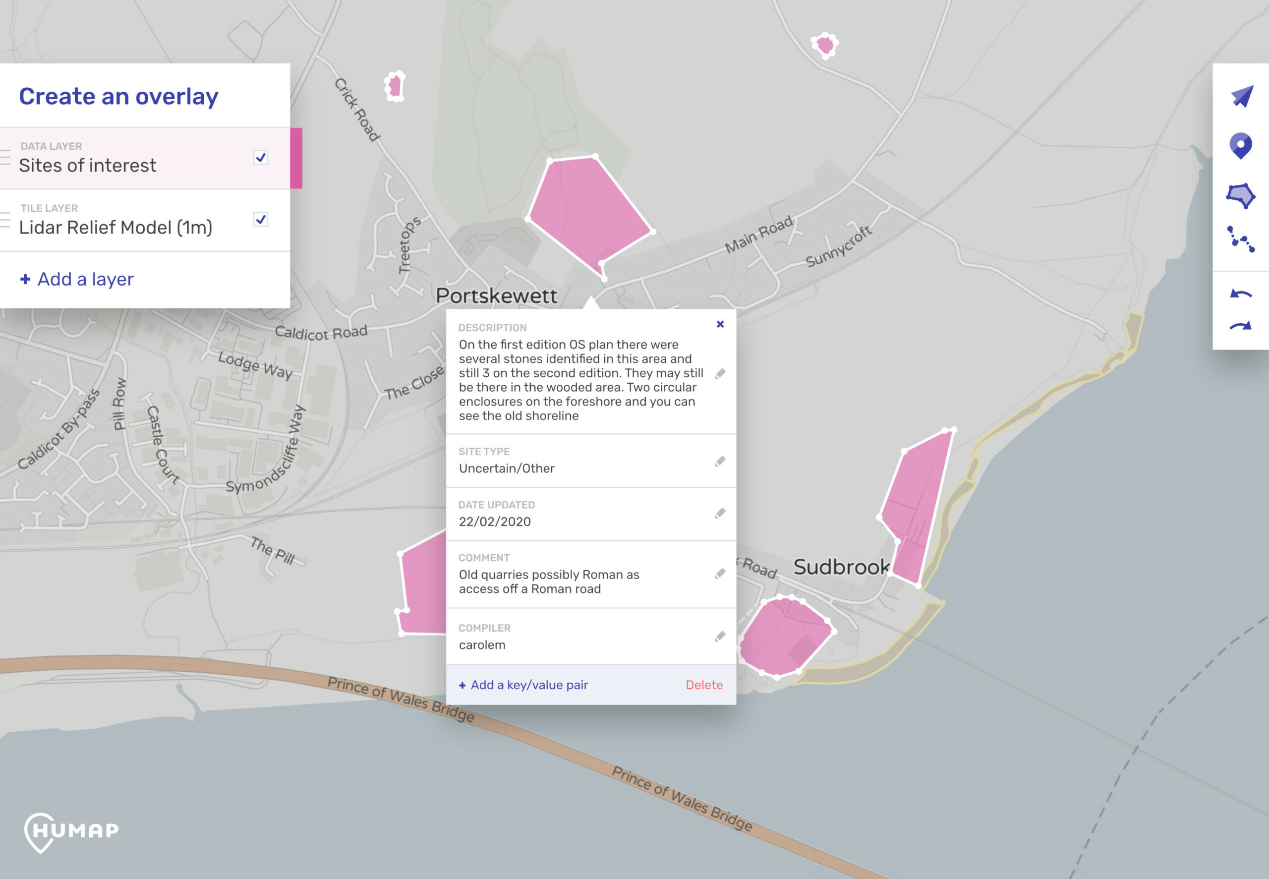
Skip to content
  • Sectors

Community & Civic Engagement

Humap isn’t just a place for your organisation to shine. With our map crowdsourcing tools you can invite the world to take part in community and civic engagement. 

From crowdsourcing citizen science data to providing a space for people to share historical knowledge, Humap has all the tools you need to get your project off the ground – without wasting resources on untested bespoke platforms or extensive training. 

The Contribute System

Our Contribute system makes crowdsourcing user-generated content a breeze.

All your users need is an internet connection, an email, and an idea to get started. 

In minutes Contribute users can create records, collections, timelines, walking trails, journeys and teams. 

From small classroom groups to mass crowdsourcing, this feature makes sharing and learning simple and fun.

Curious? You can test this feature out on Layers of London or take a look at our tutorials page for more information

Placemaker

Placemaker is a simple, web-native, no-code citizen science crowdsourcing tool that lets people draw on maps.

This is the platform that popular archaeology company DigVentures is using to crowdsource archaeological and ecological data. This data, gathered by hundreds of volunteers, will then be used to inform ecological and heritage policy.

Users can select and toggle different layers of geographical data, such as historical maps and LiDar. They can then use the drawing tools to create polygons which can be labelled with metadata and exported.

What happens next depends on the project. For example, DigVentures saves this data to a workflow for moderation.

Data created in Placemaker can also be easily exported out and into Humap.

Who is using this? 

Our strategic partner DigVentures uses Humap’s Placemaker tool to crowdsource archaeological and ecological data. This data, gathered asynchronously by thousands of geographically-dispersed volunteers, is then used to protect hidden archaeology and inform ecological policies. 

Layers of London uses the Contribute system to empower 6250+ users to share their stories. There are over 12,300 records on the map. While some of these were curated by the IHR’s partner organisations, the vast majority were contributed by public volunteers. 

These tools can also be used for smaller groups of people, such as volunteers or students working together on projects. A platform anyone can use 

Humap truly is an easy to use mapping platform. Our users don’t have to download an app or any software, and (unless they want to) they never have to code.

The platform works great on computers, mobiles, and tablets, and we’re proud to have users ranging from children in the classroom to senior citizens enjoying Humap. 

Frequently Asked Questions

How is the Contribute system moderated?

At the moment the only way to moderate public contributions is to give feedback at the bottom of a piece of content and then leaving either a positive or negative report.

We are exploring options for moderating publicly contributed content before publishing.

Are there any limitations on the Contribute system?

At present, overlays cannot be added via Contribute.

While images, video, text, and audio can be added to records via Contribute, at present IIIF, Sketchfab, and QR codes can only be added via the admin content management systems.

 Who can contribute?

There are different levels of access. 

Layers of London is open to anyone with an email address.

DigVentures screens their volunteers and only gives access to their chosen users. 

We have Single Sign-On for Microsoft, Google and Apple, and we’re working to expand this feature. 

It is possible to restrict access only to users with a specific email domain while keeping public signups open, so that only people in your organisation will be able to sign up.

Send a message

How can we help?

We usually respond in a few hours