Our citizen science crowdsourcing map tools are perfect for innovative, inclusive, cost-effective research.
We have two citizen science map tools perfect for crowdsourcing at scale: Humap and Placemaker.
Our citizen science crowdsourcing map tools are perfect for innovative, inclusive, cost-effective research.
We have two citizen science map tools perfect for crowdsourcing at scale: Humap and Placemaker.

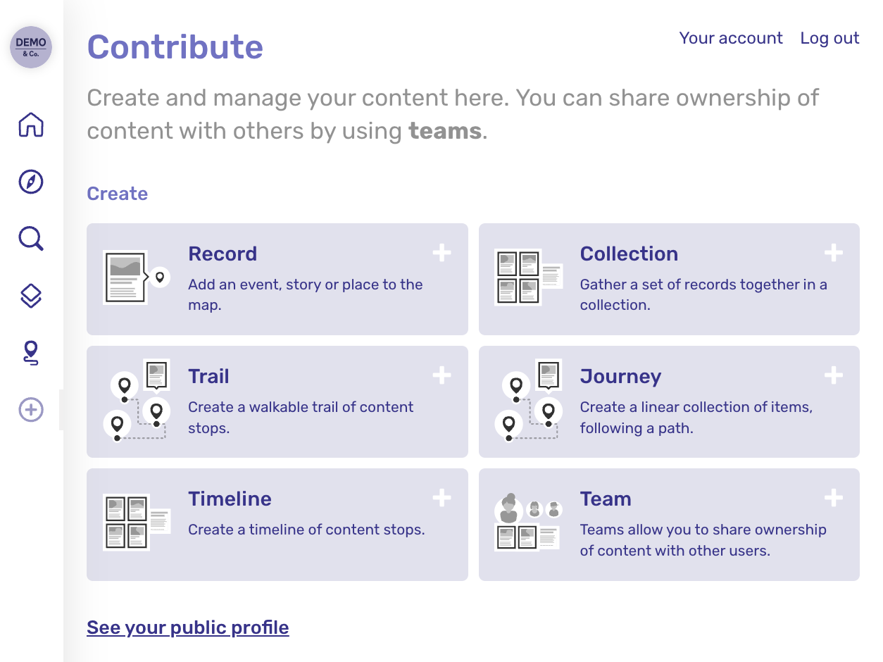
Our user-generated content system empowers anyone to add to the map, so the sky’s the limit on volunteer numbers. Humap is fully multimedia, enabling your volunteers to upload evidence and data in whatever format is needed.
Humap is no-code, web-native, and device-responsive. We designed to be usable by all age groups and demographics, so you can invite the world to take part in your project.
It’s also a great place to display your findings, as its dynamic user experience makes complicated data fun and accessible.
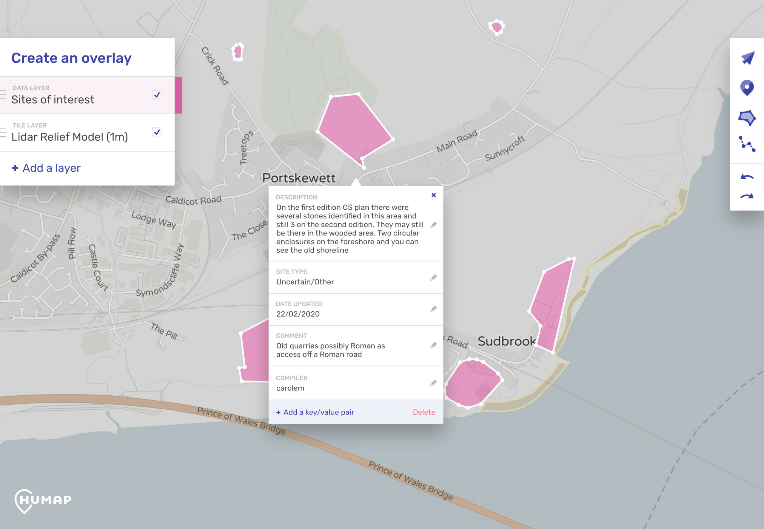
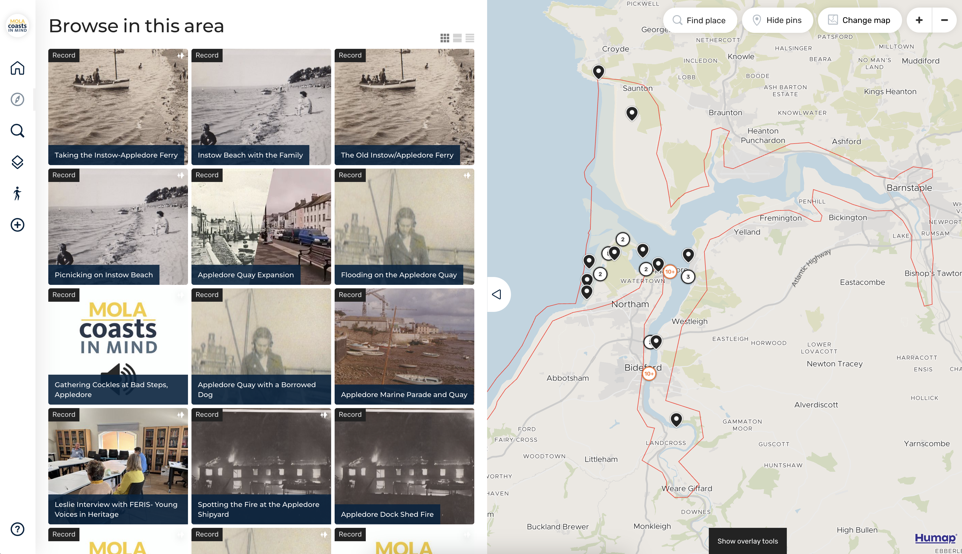
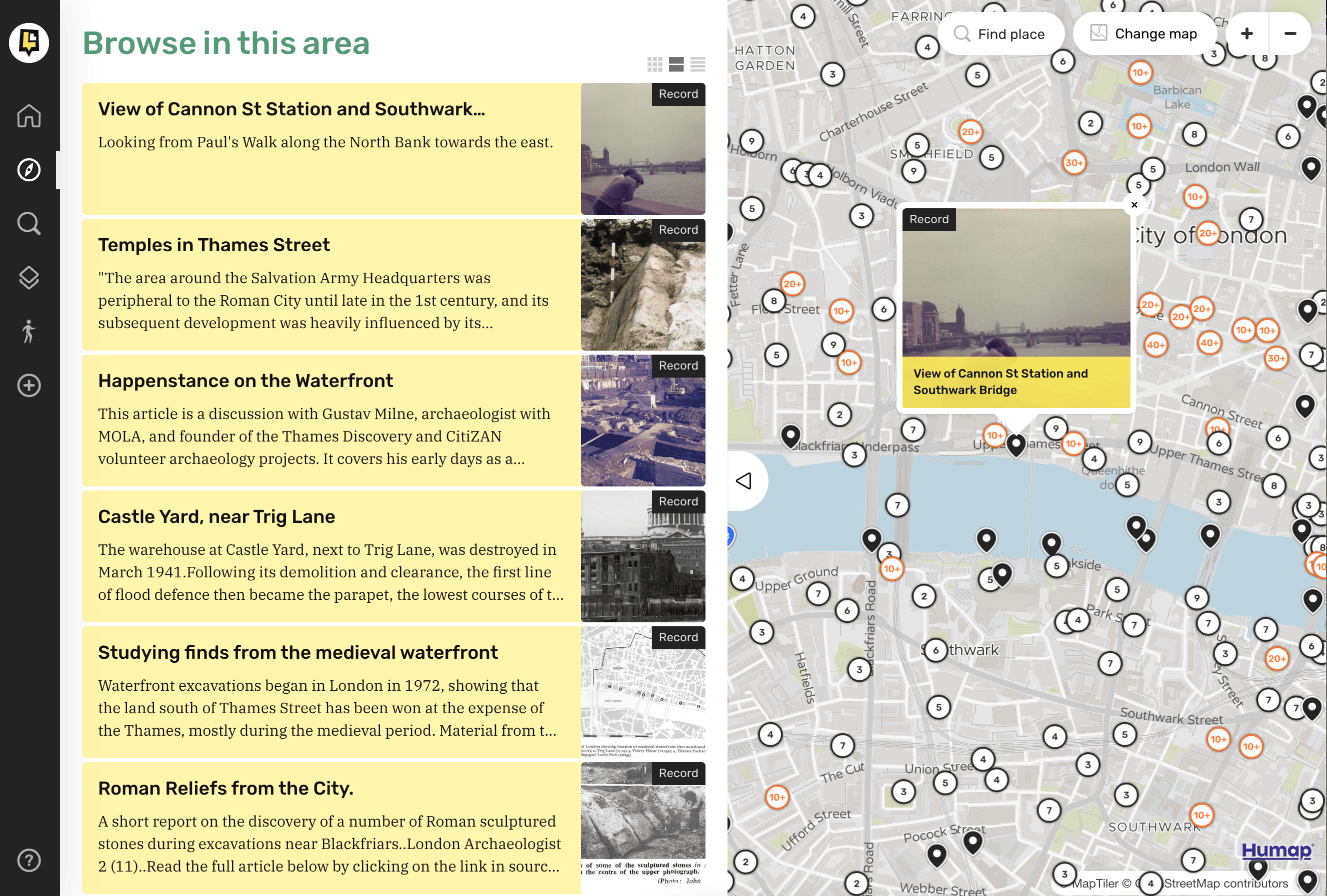
Supported by the Heritage Fund, Historic England, and Lloyds Register Foundation, the Museum of London Archaeology is using Humap to generate multimedia temporal and spatial data on coastal erosion.
The Coasts in Mind initiative draws on vernacular photography and the power of memory, using the power of public engagement to create an informed understanding of coastal erosion and the threats of climate change.
This project is still ongoing. You can learn more on MOLA’s website.
Layers of London is a multimillion-pound digital archive created by the University of London’s Institute of Historical Research. Layers brings together geo-rectified historical maps of London, curated collections created by project partners like the British Library, and the power of the public to share and commemorate what they love about London.
From a collaborative project aiming to map every pub in London to community groups mapping their history and the resources available to them, this map has a little bit of everything.
This project is more cultural than scientific, but it shows the power of and need for community-generated data.
At time of writing in January 2025, Layers of London has over 6,500 signed up users and over 12,800 records!
Learn more | Take a look | Academic Research on Humap | Cultural Heritage on Humap
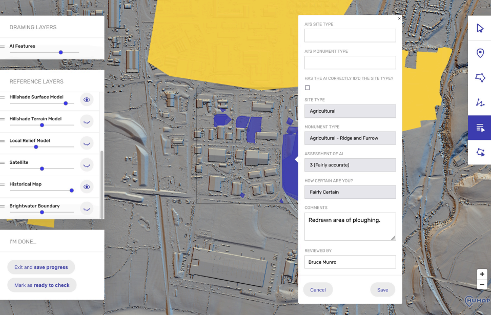
Placemaker is a Participatory Geographic Information Systems (PGIS) tool. It makes drawing on maps simple and fun, no expensive and time-consuming GIS training needed.
Users are assigned an area of land, and given access to data uploaded by the project team (satellite maps, historical maps, LiDAR data etc). The users can then compare and contrast these data sources and create polygons and metadata around their findings.
Placemaker has so far been used to analyse landscapes for archaeological, ecological, and habitat data.
Like Humap, Placemaker requires no coding or downloads and is suitable for a broad range of users.
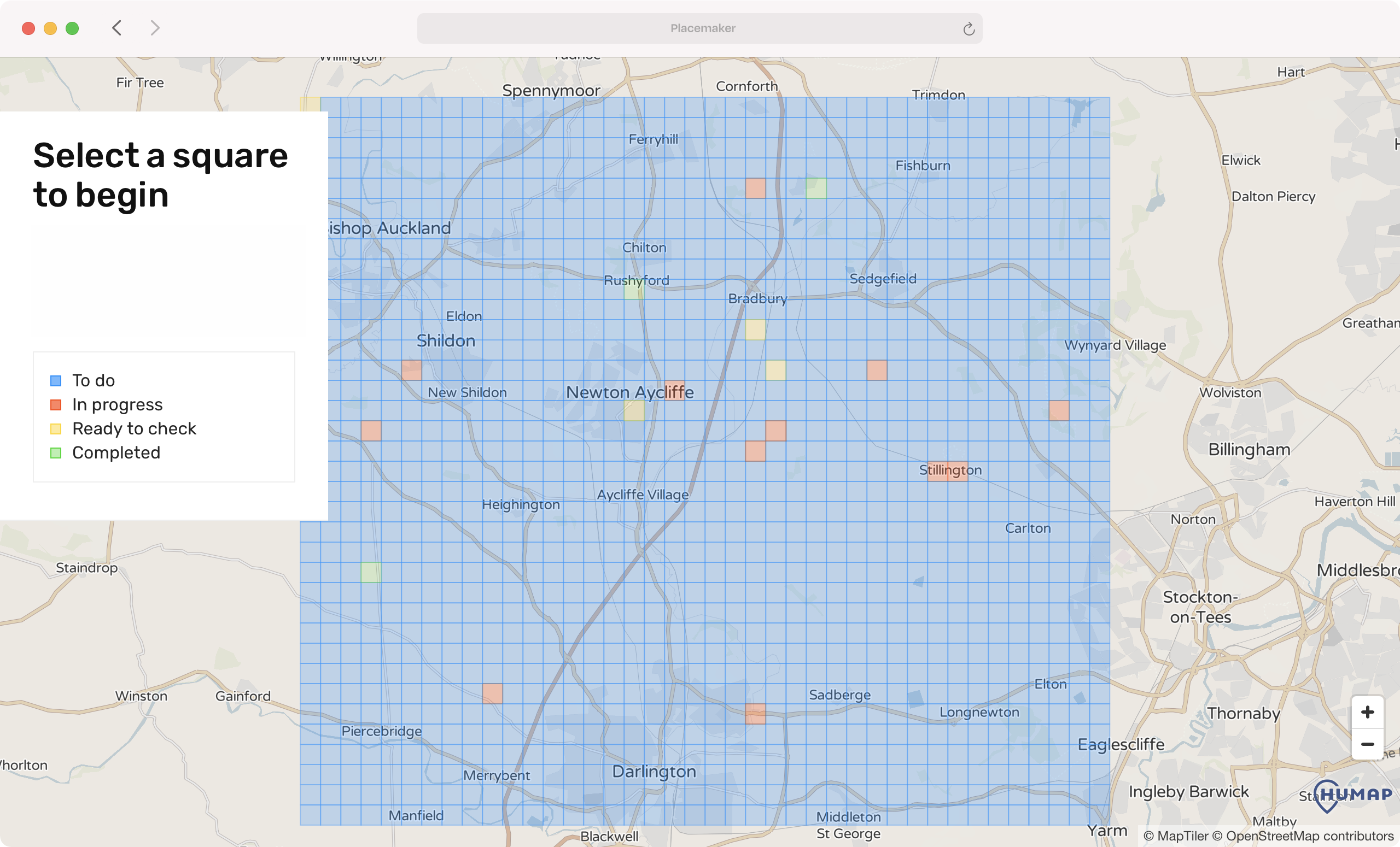
DigVentures is a UK-based archaeology firm. They have used Placemaker to create Deep Time, a portal for crowdsourcing spatial data from thousands of expert-trained citizen scientists working remotely and asynchronously.
These citizen scientists can survey vast quantities of land quickly, the results of which are then validated by professionals. DigVentures has partnered with the National Trust, Natural England, Nesta and several other institutions here in the UK to deliver a series of Deep Time projects, each with incredible results.
During their most recent project with Natural England, 1,208 citizen scientists from 32 countries mapped 58,000 habitats across 5,391km²!
Learn more about Deep Time | Archaeology on Humap
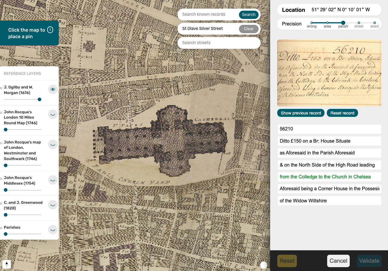
Amicable Contributors is a crowdsourcing platform led by the University of Cambridge Group for the History of Population and Social Structure, with support from Aviva, one of the UK’s oldest insurance companies. The project invites volunteers to help uncover historical data by locating addresses and transcribing text from centuries-old insurance records.
Participants identify where each record belongs on the map using Placemaker and then transcribe its contents, with all submissions reviewed and verified by professional researchers before publication.
We’re looking to partner with citizen science outfits, especially those working in the environmental and ecological spaces. If this is you, get in touch with us at [email protected].