Skip to content
  • Case studies

AM

Who are they?

AM (formerly Adam Matthew Digital) is an award-winning academic publisher specialising in the social sciences and humanities. Founded in 1990, AM began by publishing microfilm collections of source materials.

Over the years AM has partnered with such institutions as The National Archives (UK)The Newberry Library, and The Gilder Lehrman Institute – digitising their collections and transforming them into interactive learning experiences. The AM Quartex platform is an industry leader in both asset management and educational technology.

Pictured right: The Newberry Library, Chicago.

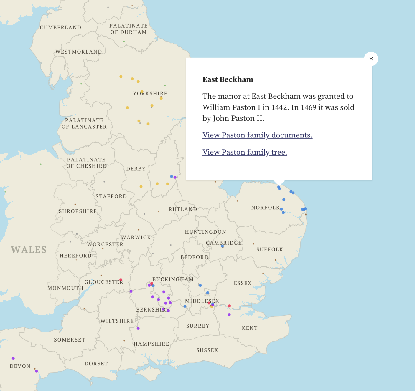
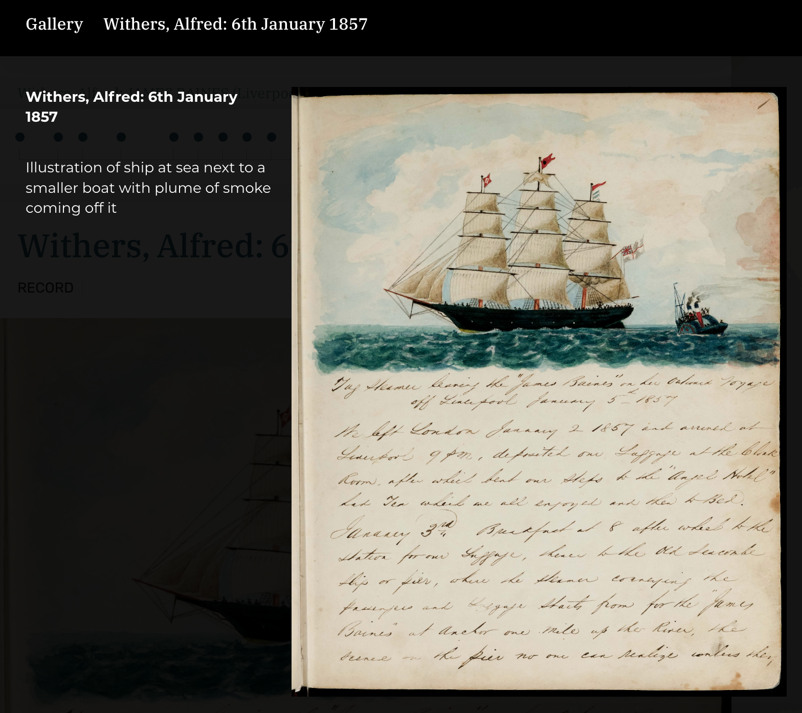
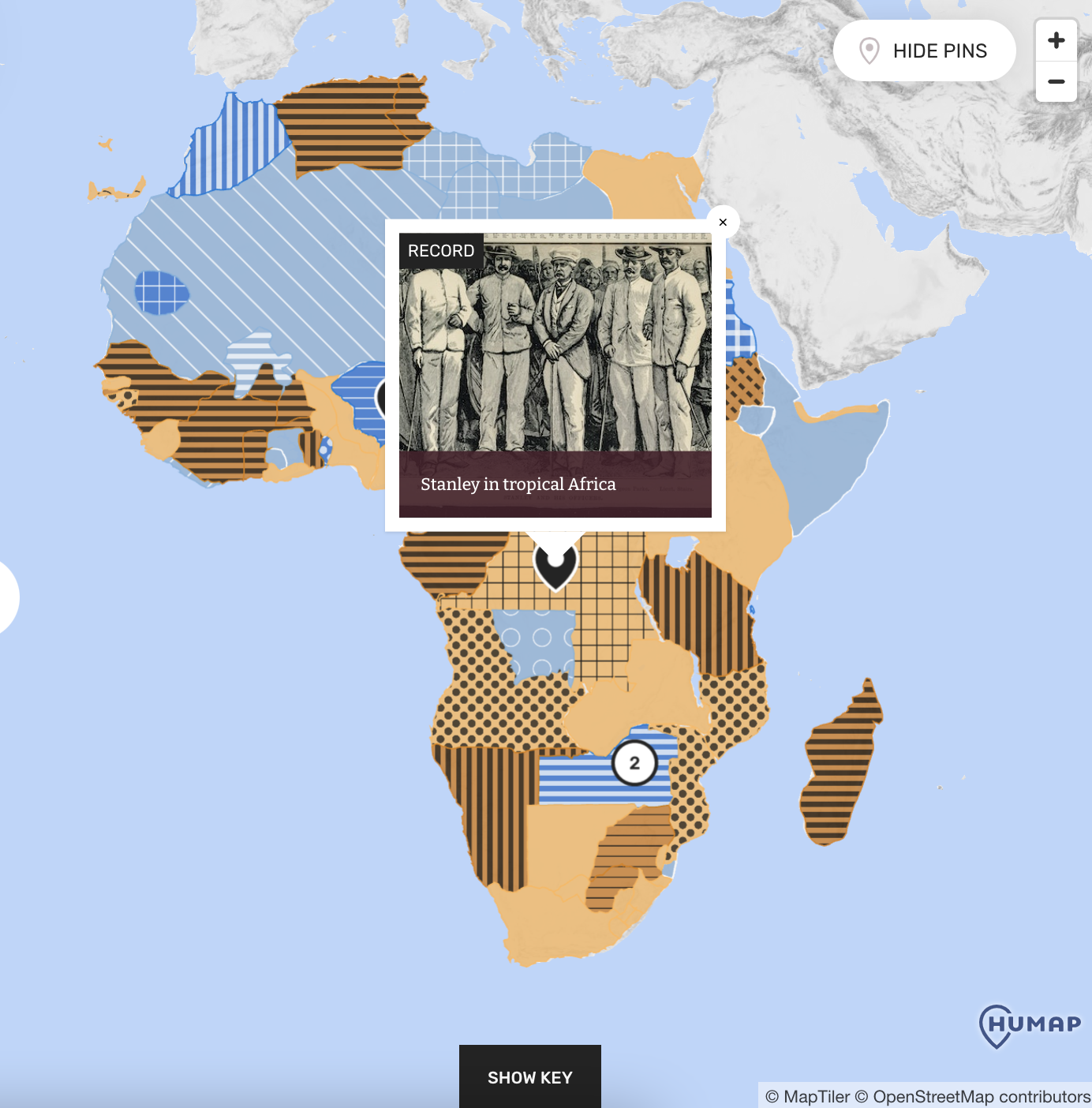
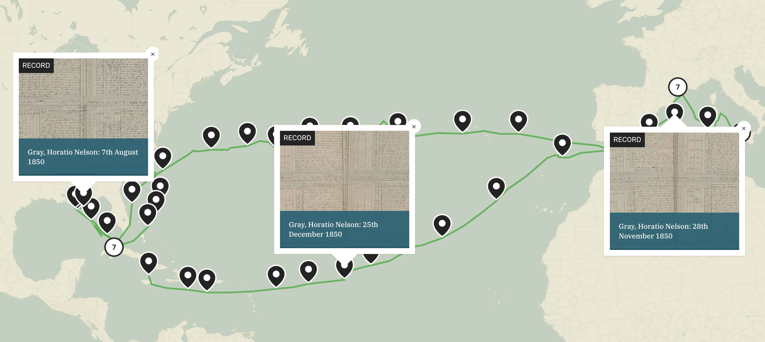
Header image from Life At Sea: Seafaring in the Anglo-American Maritime World, 1600-1900 © Adam Matthew Digital Limited, 2022.

What was the challenge?

AM needed a white-label interactive mapping solution that could integrate with AM Quartex. While some of the maps would be completely new products, others would be updated versions of older resources.

These maps needed to look and feel consistent while making use of different aesthetics and curation strategies.

Obsolescence also needed to be removed as a pain point. One-off bespoke developed maps have a tendency to age quickly, so AM were keen to find a solution that would future-proof their products and ensure the survival of engaging and accessible features.

All of this had to live up to AM Quartex’s extremely high standard of user-friendliness – for both the end users and AM’s editorial teams. 

That’s where we come in…

Image from Medieval Family Life: The Paston, Cely, Plumpton, Stonor and Armburgh Papers © Adam Matthew Digital Limited, 2022.

What was the result?

AM has launched several maps on their platform using integrated Humap technology.

Medieval Family Life: The Paston, Cely, Plumpton, Stonor and Armburgh Papers is a primary source product that has recently been refreshed. This resource features a visualisation that uses data overlays to map out the lives of medieval families in the UK, as well as sites of interest such as castles and towns.

Life At Sea: Seafaring in the Anglo-American Maritime World, 1600-1900  is a new product. This resource uses our routes and timelines features to turn sea voyage diaries into an interactive experience.

Africa and the New Imperialism: European Borders on the African Continent 1870-1914 is also a new product. This map combines a huge range of primary sources with data overlays to create a comprehensive narrative of Europe’s imperialist expansion into Africa. 

All of these use innovative digital curation techniques to turn archival sources into engaging narrative experiences.

These maps will be viewed by thousands of educators and researchers around the world, supplementing traditional curricula and helping ensure that valuable source materials are preserved and shared.

Image from Life At Sea: Seafaring in the Anglo-American Maritime World, 1600-1900 © Adam Matthew Digital Limited, 2022.

Why Humap?

Humap is designed for maximum versatility and easy white-labelling, so fitting it in and around AM’s existing software was relatively simple. We have a REST API and our dev team has worked hard to make sure that integrating Humap is about as easy as embedding a YouTube video. 

As we are responsible for providing a comprehensive SLA and uptime guarantees, becoming one of our commercial partners removes obsolescence as an issue. This saves our clients time and money and ensures product longevity.

AM were also able to choose from a huge range of features, and work directly with our dev team to create maps that were truly unique to them. As we are committed to upgrading our platform, AM can expect to see new features and functions rolled out throughout our partnership. 

We take our commitment to user-friendliness seriously, and our no-code, web-native CMS empowered the AM team to jump right in and start creating and curating content. They can also come back and edit the maps at any point, ensuring that they stay relevant. 

Image from Africa and the New Imperialism: European Borders on the African Continent 1870-1914 © Adam Matthew Digital Limited, 2023.

“From the outset, the Humap team had a real flexibility in their approach and a keen understanding of the core concepts across our map features. Working with maps and in a new platform presented several challenges but Ed and Martin were always keen to work towards a solution together.

Working with Humap has given some more autonomy in what we can achieve within our own team when working with map features, and empowered us to take on elements of production which were previously challenging to access.

The user experience is something which is central to all of our products and Humap allowed us to produce powerful visual tools for understanding and contextualising periods of history. For Life at Sea, we have been able to draw out the stories of the individuals within the material, which was core to the purpose of the product as a socio-cultural resource exploring maritime history.

The team at Humap work hard to understand the vision for each map they produce and are enthusiastic in understanding any challenges and working together to find solutions.

A big challenge for us was conforming to WCAG AA accessibility standards when working with a broad range of colours. The work that Humap did to add patterns and outlines really enhanced the accessibility of the map, which was something which was crucial to us as one of our missions as a company.”

– Natalie Dale, Senior Editor

You could build something this amazing too.

Schedule a 45-minute call with our team today for a personalised platform demonstration and quote.

Book a demo

Send a message

How can we help?

We usually respond in a few hours